SIMSPATIAL GIS CONSULTING
Making the world better with maps.
SimSpatial GIS Consulting is here to help you get the most out of your geodata.

Web Maps
Use custom modern web mapping APIs such as Google Maps or ArcGIS Online with your cloud databases and let us build your SaaS mapping products. Whatever your need, we can make it happen!
LiDAR Analysis
Use advanced LiDAR (Light Detecting and Ranging) analysis and feature extraction to build 3D models from your LAS data.
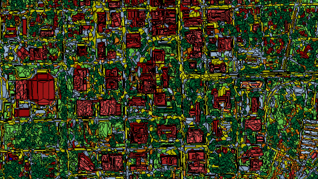
Image Analysis
Let us design imagery processing pipelines, ETL processes, or even combine LiDAR and Satellite Imagery with Object-based Image Classification Algorithms to more accurately classify your EO data and turn your Geodata into GeoIntelligence!
Portfolio Overview
NSGIS 4.0
‘Single Pane of Glass’ mobile-first, SaaS GIS Platform. Seamless Integration of over 120 map services for Norfolk Southern Engineering and Operations Teams. Built with ArcGIS Server, Oracle Spatial, ArcGIS JavaScript API, React/JavaScript/Node.JS and integrating 3rd party map endpoints, video feeds, and live weather APIs.

NSGIS 4.0 SaaS Web & Mobile App
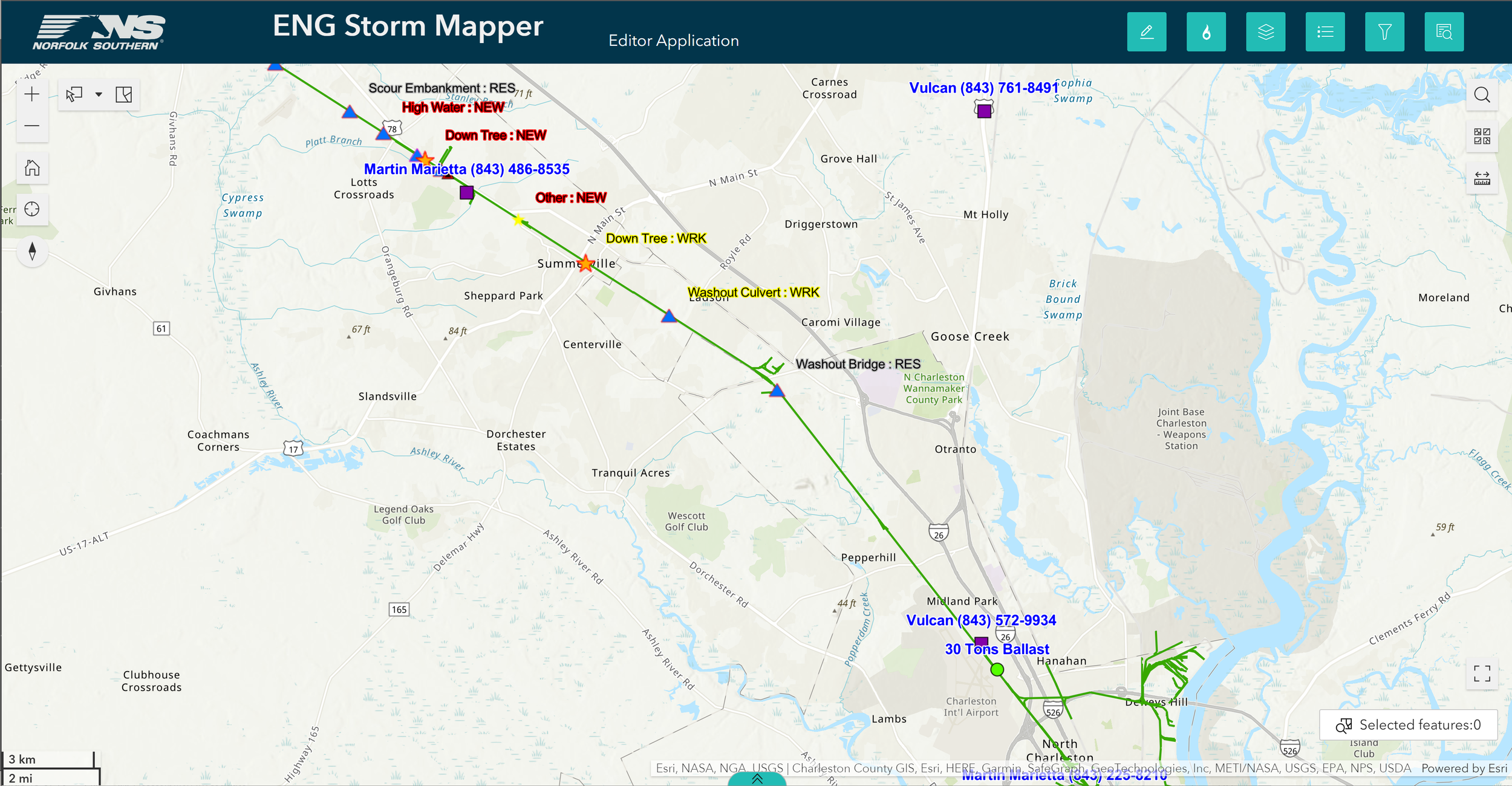
Storm Mapper
Real-Time Disaster Response Map Platform with Mobile App serving Norfolk Southern’s Field Operations. Built with ArcGIS Online, ArcGIS Field Maps, ArcGIS Server, and Oracle Spatial.
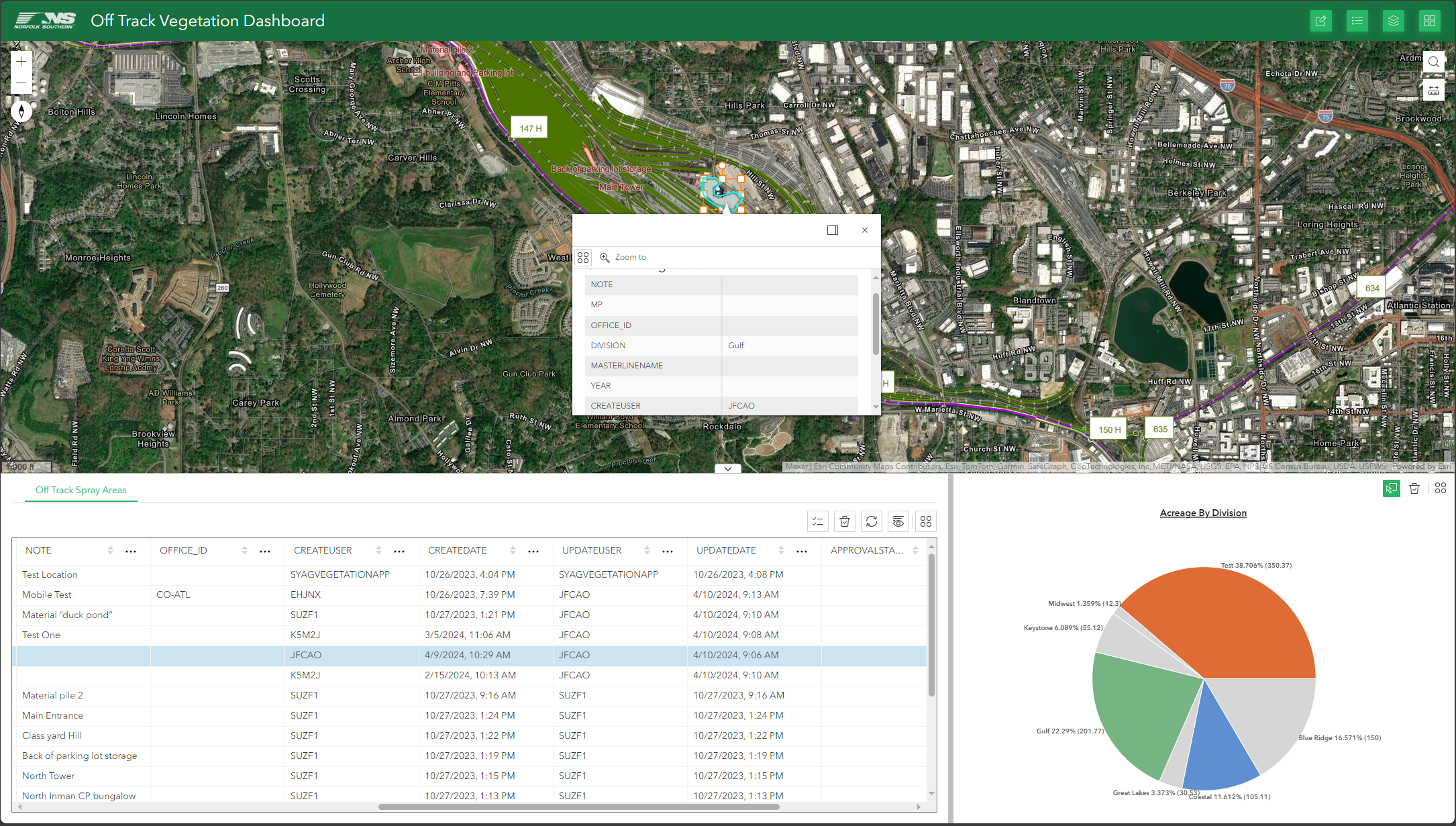
Off Track Vegetation Planner
Geospatial Project Planner for Vegetation Management. Built with ArcGIS Online, Oracle Spatial, and ArcGIS Server.
Trachoma Atlas/NTD Mapper 2.0
Open Source Web Mapping Platform for tracking Neglected Tropical Diseases and Medicine Distribution in Africa and India. Built with Google Earth/Maps API and CartoDB backend.
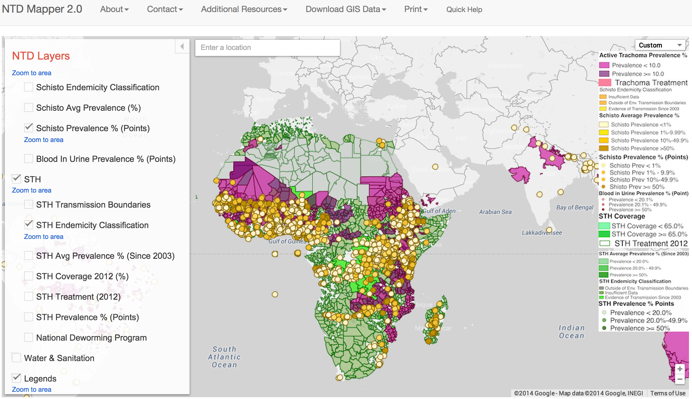
NTDMAP.ORG
The Task Force for Global Health
Goals
To produce a license-free GIS solution for the democratization and distribution of public health data and allow the visualizing and distribution of Neglected Tropical Diseases (NTD) geodata to global stakeholders. The requirements were for a product that performs quickly and allows for the easy visualization of data online and allow the user to download the underlying shapefiles offline when there is limited internet connectivity, all without cost to the end user and without requiring expensive licenses for GIS software.
Solution
A Cloud-based GIS solution (Google Cloud Storage and Google Maps Engine) coupled with Free and OpenSource GIS Software (QGIS) is used to achieve the goals of The Task Force for Global Health. An cloud-based SaaS mapping website was developed using JavaScript/HTML with a Google Cloud Storage backend to allow stakeholders all around the globe to visualize, print, and download NTD prevalence and treatment GIS data. Once downloaded, this GIS data and templates can be used in QGIS or any other leading GIS software to recreate all maps from the online tool as well as allow for custom analysis or visualization without the need for an internet connection or expensive GIS licenses
Version 2.0
With Google Ending Support for Google Maps Engine in early 2016 swift action was required to migrate from one cloud-based GIS platform to another with minimal effort and maximum speed. Enter CartoDB.com, a cloud-based, PostgreSQL backend with a rich JavaScript API. SimSpatial helped The Task Force for Global Health migrate their geodata and map style settings from Google Maps Engine to CartoDB.com, configure new map services, and revamp the NTDMap.Org website in one month without loss of functionality or data. Contact us today to learn how SimSpatial GIS can help you migrate your GIS solution to the cloud or update your existing implementation.